Historic Markers-Harmon County OK
Renee
- posted on
- Comments Off on Historic Markers-Harmon County OK
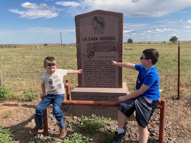
Our summer has looked a little different this year due to the Covid-19 outbreak. Instead of going on a “typical” vacation to some far off destination, we have been making day trips to places around us. Last weekend we ventured out to Harmon County to try to see all of the historic markers. We used the website https://www.okhistory.org/about/markers as our guide while we explored our neighboring county. Harmon county is in the southwest corner of Oklahoma, just a rock’s skip away from the Oklahoma/Texas state line. In fact, Hollis was once part of “Old Greer County”, which was part of Texas. The town of Hollis was re-platted in 1903, changing the Oklahoma border and making Hollis a town in Oklahoma. In 1909, Old Greer County was divided in two… Hollis became the county seat of Harmon County. It has been very interesting learning about the history of these places around us. These seemingly empty little towns hold interesting pasts that few of us realize. Our first stop in Harmon County was the La Casa School Marker .
The actual school was located 5 miles south of this marker. The school was formed by consolidating three schools: Mesquite, Star Valley and Bearden. Classes began in a new building after Christmas 1925, with the first graduate in 1928. La Casa was the nucleus of most community activities. La Casa’s era ended in 1957, due to dwindling school attendance. Students began attending Gould and Hollis schools.
After checking out the La Casa School marker, our next stop was in Hollis at the Harmon County Courthouse.
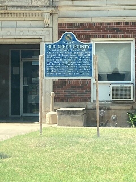

South and West of the North Fork of the Red River, Greer County was named and governed as part of Texas from 1860 until 1896 when a US Supreme Court decision made it part of Oklahoma territory. This county area was claimed by 14 different governments from 1669 to Oklahoma’s statehood in 1907. Since then, it has been divided into three counties and the south part of Beckham county. After checking out the courthouse, we traveled outside of Hollis to the 100th Meridian marker.
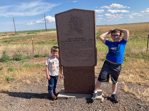
The 100th meridian first marked the boundary between the Republic of Texas and the vast Louisiana Purchase. Establishing this boundary was one of the most far reaching events in which the nation engaged. In 1927 the U.S. Supreme Court established the OK/TX state line along this boundary. The 100th meridian chapter, NSDAR dedicated this project to identify this state line located 4 miles west of Hollis, OK, on U.S. highway 62.
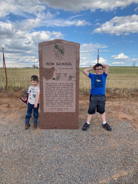
Our next historical marker on our list was Ron School. Ron School was located 3 miles east and 1/2 mile south of this marker. The school was formed in the spring of 1939 by a special election to consolidate schools of Dryden, McKnight, Metcalf, and Tearcross. The first senior class was 1939 and the last class to gradute was 1964 when Ron School was consolidated with Hollis Public Schools.
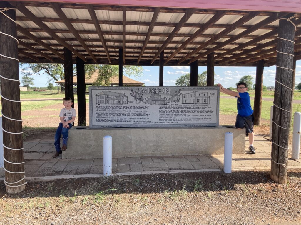
Our final stop was in Vinson, a town located on OK State Highway 9. A post office was established here on August 20, 1903, named for Henry B. Vinson, the owner of the townsite. The Vinson School closed in 1964 after serving children for decades from the surrounding communities of Cave Creek, Independence, Union Grove, Madge, Opal, Carl, Sulphur, Union Hill, Hurst, Hackberry, and Elm Valley.
This was the last stop on our Harmon County adventure. It was wonderful to get out of the house, with the family, and learn more about the world that is around us. What a refreshing respite from the turmoil that seems to surround us in 2020. We will explore another county soon… I wonder which one we will choose?
-Renee’